Yes, the economy. It keeps me THINKING about travel (or, sometimes not, as it can get depressing!), but my family is not DOING it as much these days. When I get feeling a bit 'trapped' in my surroundings I know it's time to pick up a book, and take an 'imaginary' journey. I LOVE this book - just to read about places that I should go (or, realize, maybe I can skip!).
Technically, I have not made that 'life list' as I truly enjoy any sort of adventure near or far, but must admit, there are a few places that stand out in my mind... BUT, I have kids, and some of the places I need to wait until they are older (yet make sure I am not TOO old. A fine line!) With so many choices and information in this one book, it is easy to find any type of trip imaginable.
1000 Places To See Before You Die takes you 'all over the world' and opens with the quote "Life is not measured by the number of breaths we take, but by the places and moments that take our breath away". Search the book by continent, activity, theme, mode of travel and more. I'm thinking focusing on the "Festivals & Events" section could take me a lifetime or two (and those tiny 'check boxes' beside each item in the index are calling at me to check them off!!).
We read parts of the book to our kids. Our 6-year old is especially curious and enjoys hearing snip-its about the Taj Mahal, the Lesser Antilles, or the New Orleans Jazz & Heritage Festival.
So, when in doubt, get some books out. Take those imaginary journeys or plan for the next REAL journey. You may learn something, and it'll get you excited to explore (and motivated to start saving!).
We love maps, all kinds, as they provide a huge range of easy to look at information about an area. And, we're NOT talking about maps that highlight 'attractions', 'top restaurants' or the nearest 'rest area' (although, admittedly the latter can be very important!)
We feel that when we are planning a trip it's important to learn about topography, culture, geology, climate and historical landmarks, you know, all that 'educational' stuff. BUT, it's all so interesting. Have your doubts? We find kids really like the interaction, and pictorial depiction of information on a map. It's visual.
Here's a quick list of 5 basic map types, sites we like to use, and a couple of suggestions of what to do with them.... (each type is a 'blog topic' in itself, and may still become one, but we are going 'light' for now!)
Road Maps: we're all probably most familiar with these. These are the ones with various quality roads, from major highways to minor dirt roads. They also have cities, towns, railways, airports, and some places of interest. We like to go to Google Maps or Expedia and print out simple maps for our kids to follow along when we drive somewhere. Doesn't even have to be that far (their attention spans don't usually last hours on end for 'navigation' anyway). Also, AAA is a great resource for these types of maps
Climate Maps: these types of maps tell about weather, rain/snow etc., making them extremely useful when planning a trip! You may be headed to a warm place, but did you realize it may also be monsoon season?
Resource Maps (also included in this map group is 'Economic'): this type of map features natural resources of an area, which often reflects the economy of a region. We like to use these maps to teach kids about where things they may use everyday come from. Although we love to buy local, sometimes (and some seasons) things must come from far away. It's also good for kids to understand where major things come from, such as oil, or lumber.
Political Maps: these maps show state and/or national boundaries, and usually include capital cities. We like to make quiz each other (even as an adult, I must sadly admit, my country capital knowledge is NOT as good as I wish it were), and in doing so, we learn as much as the kids do. Want to make it simpler? Just teach the capitals of the states you will take your next road trip through, or the next country you fly to.
Physical Maps (and this could include Topographic - one of our favorites, and Geologic): this type of map shows the physical features of an area, such as bodies of water and mountains. Plan a hike, and use the map to 'predict' the topography, or the "ups & downs" you may encounter along the way. Will it be steep? Is there a river crossing? You can even do this in your own back yard. Print out your own topo maps for FREE HERE.
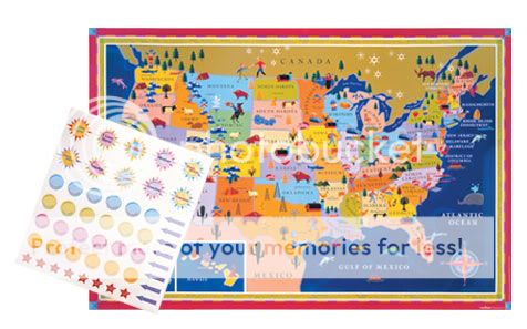
Some of the best maps we've found for kids that show a combination of the map types listed above including animals that live in certain areas are from eeBoo.


 Yes, the economy. It keeps me THINKING about travel (or, sometimes not, as it can get depressing!), but my family is not DOING it as much these days. When I get feeling a bit 'trapped' in my surroundings I know it's time to pick up a book, and take an 'imaginary' journey. I LOVE this book - just to read about places that I should go (or, realize, maybe I can skip!).


