There are nearly 400 National Parks in the United States, and they provide a great way to save money and give the kids a great travel experience (yes even as the cold weather approaches).
Most popular - do you have a guess? Grand Canyon? Yellowstone? No, it's the Great Smokies National Park in TN/NC SEE MORE. With over 800 miles of hiking trails. however, you will still be able to get away from others if you choose!
Check out some of the less visited (but equally spectacular) in a pictoral Slide show (this is wehre we'd rather go, personally!)
Flashcards WORLD landmarks are perfect to pass the miles and learn about (plan!) the NEXT travel destinations
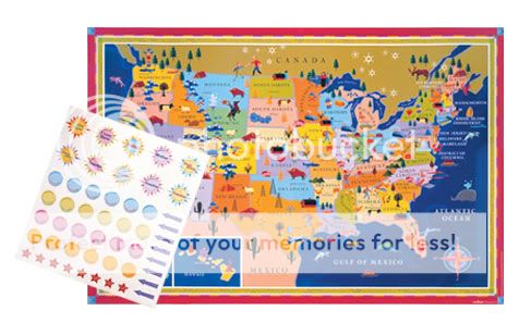
Road Maps for Kids are a fun way to keep kids involved with navigation, or relative placement of states in the United States (and other fun facts too!)
Take your kids once a year (or more, of course) to this great network of protected lands, which the US can take credit for establishing. You'll find yourself enjoying it as much as the kids (and, perhaps more)
Congratulations, and thanks to all of you for your comments and tweets! Much appreciated. Join us again for October's giveaway later this month, and for another BLOG entry this week!
Inflatable Globe from Toysmith - learn about the world, pack a ball for the beach!
WORLD MAP Reusable Vinyl Sticker Play Scene Set. Dream about where your next adventure will be
a $25 value, and we'll even ship it for FREE to any U.S.A. address
It's Easy to WIN, first choose one of the preferred (but NOT mandatory) methods (or BOTH) of entry (worth one each)
become a follower of the BLOG (on the right-hand column) OR follow KidsTravelHappy on Twitter OR both for 2 entries (if you already follow, just comment below to get credit)
ADDITIONAL Entries (feel free to participate in any or all of these!)
Tweet about this contest by copying this " I just entered to win a 'Set of Maps for Kids' from @KidsTravelHappy http://tinyurl.com/c6ptco "
We love maps, all kinds, as they provide a huge range of easy to look at information about an area. And, we're NOT talking about maps that highlight 'attractions', 'top restaurants' or the nearest 'rest area' (although, admittedly the latter can be very important!)
We feel that when we are planning a trip it's important to learn about topography, culture, geology, climate and historical landmarks, you know, all that 'educational' stuff. BUT, it's all so interesting. Have your doubts? We find kids really like the interaction, and pictorial depiction of information on a map. It's visual.
Here's a quick list of 5 basic map types, sites we like to use, and a couple of suggestions of what to do with them.... (each type is a 'blog topic' in itself, and may still become one, but we are going 'light' for now!)
Road Maps: we're all probably most familiar with these. These are the ones with various quality roads, from major highways to minor dirt roads. They also have cities, towns, railways, airports, and some places of interest. We like to go to Google Maps or Expedia and print out simple maps for our kids to follow along when we drive somewhere. Doesn't even have to be that far (their attention spans don't usually last hours on end for 'navigation' anyway). Also, AAA is a great resource for these types of maps
Climate Maps: these types of maps tell about weather, rain/snow etc., making them extremely useful when planning a trip! You may be headed to a warm place, but did you realize it may also be monsoon season?
Resource Maps (also included in this map group is 'Economic'): this type of map features natural resources of an area, which often reflects the economy of a region. We like to use these maps to teach kids about where things they may use everyday come from. Although we love to buy local, sometimes (and some seasons) things must come from far away. It's also good for kids to understand where major things come from, such as oil, or lumber.
Political Maps: these maps show state and/or national boundaries, and usually include capital cities. We like to make quiz each other (even as an adult, I must sadly admit, my country capital knowledge is NOT as good as I wish it were), and in doing so, we learn as much as the kids do. Want to make it simpler? Just teach the capitals of the states you will take your next road trip through, or the next country you fly to.
Physical Maps (and this could include Topographic - one of our favorites, and Geologic): this type of map shows the physical features of an area, such as bodies of water and mountains. Plan a hike, and use the map to 'predict' the topography, or the "ups & downs" you may encounter along the way. Will it be steep? Is there a river crossing? You can even do this in your own back yard. Print out your own topo maps for FREE HERE.
Some of the best maps we've found for kids that show a combination of the map types listed above including animals that live in certain areas are from eeBoo.


 There are nearly 400 National Parks in the United States, and they provide a great way to save money and give the kids a great travel experience (yes even as the cold weather approaches).
Magnet Message Maker Boredom Breakers Kit Make fun bumper stickers customized for YOUR trip!
s are perfect to pass the miles and learn about (plan!) the NEXT travel destinations